Case of Juman Mountain Forest Fire in 2017
(2017)
QAny method to evaluate damaged location by the forest fire?
AWe evaluated damaged location and trees by using artificial satellite and unmanned helicopter images.
- There are weak fire burning surface vegetation and strong fire burning canopies and trees in forest fire.
- By analyzing artificial satellite image, we identified strongly fired area.
- In addition, by comparing with unmanned helicopter image, evaluate the boundary of damaged area and the number of damaged trees.
- By using this method, we can evaluate boundary of damaged area and achieve necessary information for environmental effect evaluation.
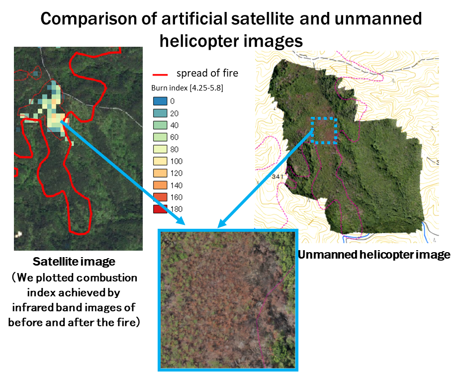
Fig.1 Comparison of artificial satellite and unmanned helicopter images
Related articles
- Does the concentration in river water change before and after forest fire? How did it change by time?
- How much did the amount or the concentration of Cs released to river water by forest fire? How did them change by time?
- Where is the radiocesium in river water coming from?
- How do rainfalls affect turbidity and radioactive cesium concentrations in river water? 【Example of analysis】
- How can the radioactive Cs distribution at the bottom of lakes or rivers be measured?