Radioactivity and Air Dose Rate
(2018)
QHow do air dose rates vary depending on radioactive cesium distribution in forests? 【Example of analysis】
AOver time, cesium migrates from trees to the ground and then migrates from the layer of fallen leaves to the soil layer. It is estimated that as radioactive cesium migrates from trees to the ground, the air dose rate 1 m above ground increases. The reason is that the radiation source is closer.
On the other hand, as radioactive cesium migrates from the layer of fallen leaves to the soil layer, the air dose rate is estimated to decrease due to the radiation shielding effect of the fallen leaves and soil. The effects from both, along with physical decay, have caused air dose rates in forests to slowly decrease to date.
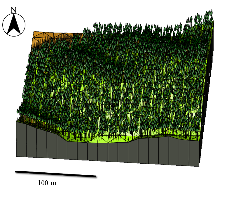
Figure 1 shows an example of calculation domain models obtained by using 3D-ADRES, an air dose rate evaluation system. Topographic features, trees, the layer of fallen leaves, and the soil layer are taken into account to assume cesium distribution.

Fig.1 Geometric model for radiation transfer analysis created by 3D-ADRES
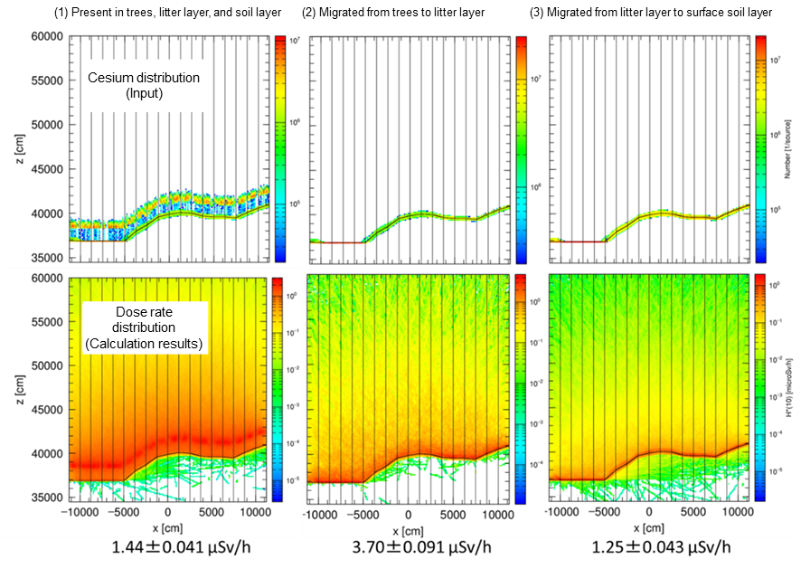
Figure 2 shows examples of calculation results at varied cesium levels in trees, the layer of fallen leaves, and the soil layer.
- (1) assumes sometime soon after the accident, when cesium was present in trees and the layer of fallen leaves in large amounts. Dose rates are high at a little more than 10 m above ground.
- (2) assumes a situation where cesium has migrated from trees to the layer of fallen leaves. Dose rates are high at 1 m above ground.
- (3) shows calculations assuming that cesium has migrated from the layer of fallen leaves to the underneath soil layer. Overall dose rates are lower.

Fig.2 Simulation results considering chronological changes in cesium distribution in forests
(Average air dose rates 1 m above ground indicated at the bottom)
Related articles
- In what kinds of land use is radioactive cesium deposited? How much is deposited?
- I heard most of the forests would not be decontaminated. Does cesium remain in the forests?
- How much radioactive cesium is released from forests? How much radioactive cesium flows into the sea?
- Where is radioactive cesium deposited in forests, and how much? How do the locations and amounts change over time?
Reference
- 佐久間一幸, 新里忠史, 金敏植, Malins, A., 町田昌彦, 吉村和也, 操上広志, 北村哲浩, 細見正明(2018): モンテカルロ放射線輸送コード(PHITS)を用いた森林内空間線量評価ツールの開発, 環境放射能除染学会誌, vol. 6, no. 3, 145-152.
