Radioactivity Dynamics in River System
(2020)
QWill heavy rain cause the runoff of deposited cesium? 【Radioactive cesium migration caused by torrential rain in October 2019: Middle to lower river basin】
AWe studied air dose rates and soil deposition situation observed before and after the Kanto-Tohoku Torrential Rain in September 2015 and the East Japan Typhoon in October 2019 (Typhoon No. 19).
As a result, we found that dose rates decreased at all sites surveyed due to sand deposition. This is presumably because soils with low cesium concentrations were washed away from river channel walls were deposited and shielded the ground, leading to lower air dose rates.
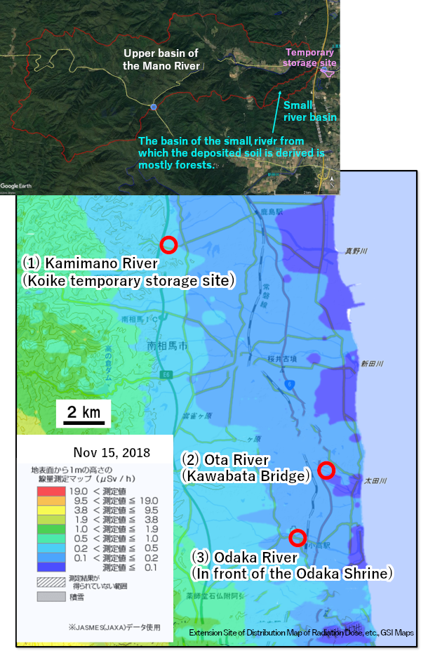
Fig.1 Survey locations in the middle to lower basin
((1) Kamimano River [Koike temporary storage site]
(2) Ota River [Kawabata Bridge]
(3) Odaka River [In front of the Odaka Shrine])
(1) Kamimano River (Koike temporary storage site): Air dose rate and soil deposition
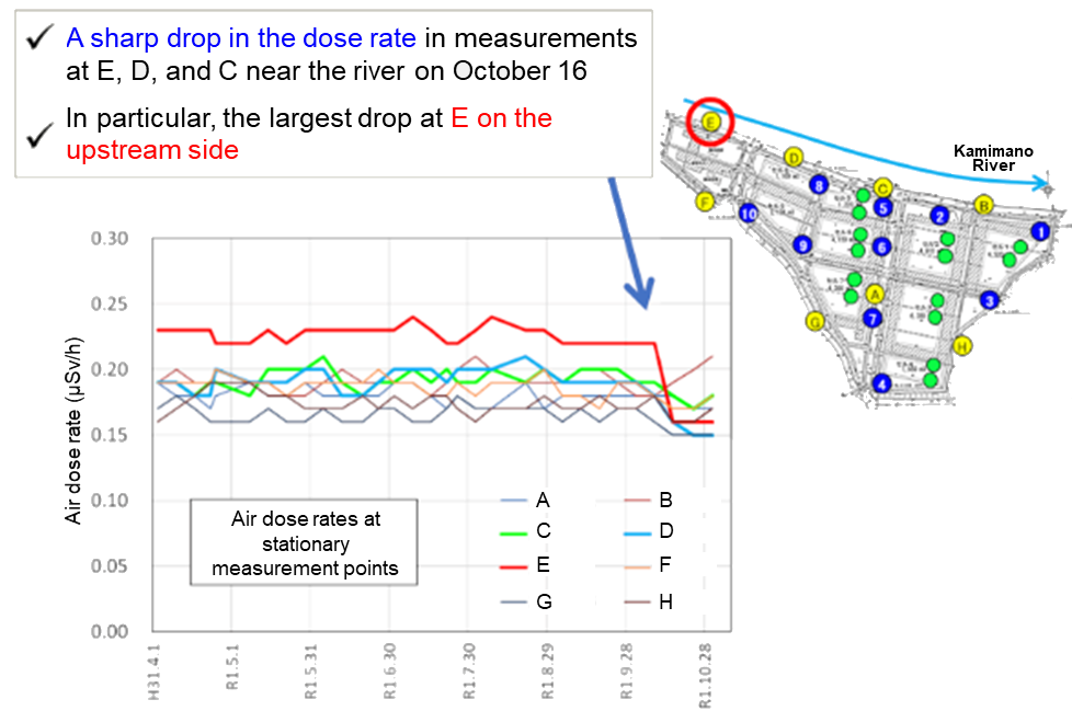
Fig.2 Air dose rates at stationary measurement points (before/after Typhoon No. 10 of October 2019)
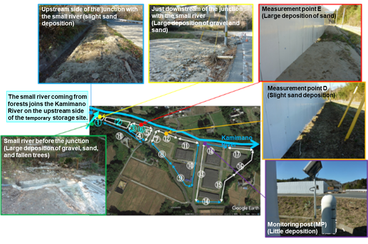
Fig.3 Soil deposition situation
Sand carried down by the small river flowed into the temporary storage site on the downstream side and deposited there, resulting in lower dose rates.
- Although some areas in the upper basin of the Kamimano River have higher dose rates than the area around the temporary storage site, the estimated origin of most of the soil deposited near the temporary storage site is the small river.
→ The origin of gravel is also the small river. There is little soil deposition on the upstream side of the junction with the small river. - The small river basin from which the deposited soil came is mostly forests.
Air dose rates on the dry riverbed of (2) Ota River and (3) Odaka River
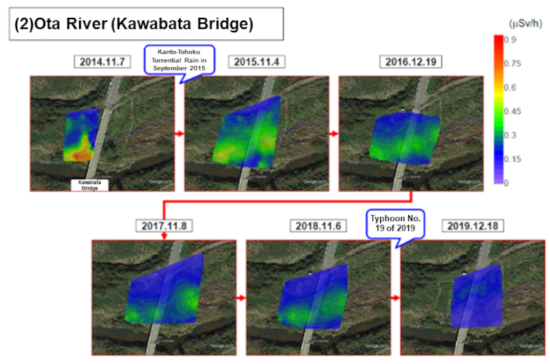
Fig.4 Air dose rates measured 1 m above ground with a gamma plotter ((2) Ota River)
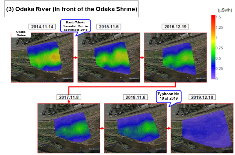
Fig.5 Air dose rates measured 1 m above ground with a gamma plotter ((3) Odaka River)
After the typhoon, air dose rates significantly decreased, reducing the area with 0.4 μSv/h or above (green to orange area).
●Origin and characteristics of the deposited soil
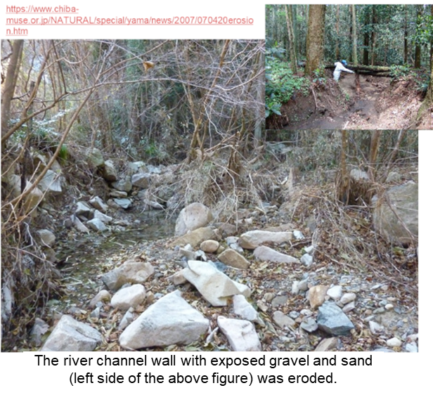
Fig.6 Soil deposition and erosion of river channel walls
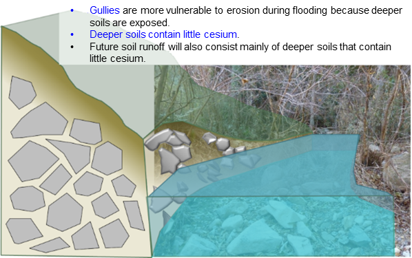
Fig.7 Image of river channel erosion during heavy rain
- Air dose rates decreased in areas of soil deposition because the deposition of soils with low cesium concentrations shielded the original ground surface.
- Why soils with low cesium concentrations are deposited.
- The deposited sand is not the surface soil of forests but decomposed granite soil, which is relatively large in grain size and resembles beach sand.
- Decomposed granite soil is mainly washed away from places vulnerable to erosion, such as gullies, which work as channels in forests.
Note: A gully is a deep ditch that is formed through the scouring of running water. - Gullies are more vulnerable to erosion during flooding because deeper soils are exposed.
- Deeper soils contain little cesium.
- It is assumed that future soil runoff associated with heavy rain will consist mainly of deeper soils that contain little cesium.
Related articles
- Will heavy rain cause the runoff of deposited cesium? 【Radioactive cesium migration caused by torrential rain in October 2019: Upper river basin】
- Do dose rates in riverbeds increase after heavy rains? 【Changes of air dose rate in heavy rain】
- Does the concentration of radioactive cesium in river water increase after rainfall? 【Changes of the concentration of 137Cs in heavy rain】
- How much amount of radiocesium discharges into the ocean?
- Dose the radiocesium discharge ratio from rivers depend on the local environment?